When an experienced expedition leader leaves, their knowledge leaves with them
Where an anchorage holds in a southerly, which route to the viewpoint avoids the crevasse field, what to say in the Zodiac when the whales show up: that knowledge lives in personal notebooks and private GPX archives today. It leaves when the person who holds it retires or moves on, and the company rebuilds it from scratch.
Guides log it from the field: a track, a photo, or a note like “downed tree on the overlook trail”. Expedition leaders vet it, accepting what belongs in the company record and resolving a hazard when it clears. Each record keeps who logged it and when, and it stays with the company when people leave.
For expedition companies
The knowledge already exists in site guides, post-voyage reports and GPX archives, and in the heads of people who leave. Cairnbase reads the documents in and files what it finds by region. Built by working expedition leaders.
The import desk
Drop in a site guide, a post-voyage report or a spreadsheet. Cairnbase reads it and shows you what it found: sites, visits, hazards, routes, facts. Nothing enters your catalogue until a person confirms it. You see the cost before anything is read.
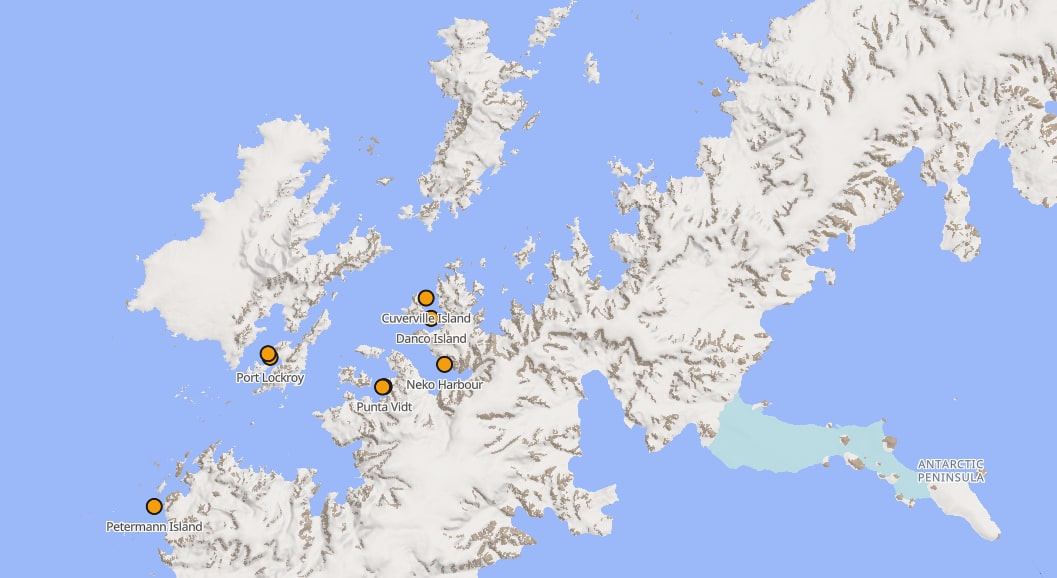
The catalogue on a map
Every site your company knows, with its visits, hazards, documents, and routes, filed by region. From a hemisphere down to a single beach.
Offline regions
Survey basemaps and terrain for the Antarctic Peninsula, Svalbard and Southeast Alaska, the Danish GL50 survey basemap for Greenland, and survey terrain on an OpenStreetMap basemap for South Georgia. Download a region in port; use it in a Zodiac with no signal.
Your data comes back out
One-click export of the workspace: its records and every original file, byte for byte, checksummed. Leave any time and take the export with you.
GPX straight onto the map
Drag a season of tracks in and confirm them on one review card. Each landing becomes a site with its visit, never a duplicate.
Accounts and sign-in
Every person who uses Cairnbase signs in with an emailed link, no password required. Guides and expedition leaders each have their own account and role, and every record sits behind that sign-in.
Your roster from a spreadsheet
Drop the guide spreadsheet you already keep: returning guides reconnect, new ones are added ready to invite, and access ends by itself on the contract end date you set.
Company workspaces are walled off from each other, and companies keep everything contributed to theirs. The terms say in writing that we never grade or correct your documentation, and how your data is handled is set out in full on the data handling page.
For guides
Most guides are independent contractors, and most of what a company knows came from guides. Cairnbase is built on one rule: what you record is yours.
Your logbook
One entry per outing: where, what you did, your tracks and photos and observations, in your own record, not a company's form.
The region in your pocket
The same regions your company uses: survey basemaps, terrain, contours, protected-area boundaries, working with no signal.
Your records are yours
Partly live
Your own account is live now, and everything you log starts there. Sharing it up to the company you work for, keeping the original forever, and carrying it to your next operator are the next pieces. We never restrict your own tracks; that rule is written into the terms.
Field capture
On the way
Hit record for a landing or a Zodiac leg, pocket the phone, drop waypoints and photos, and sync when the ship finds wifi. A native app for iPhone and Android.
Your service record
On the way
Seasons verified by the companies you worked for on Cairnbase, plus what you log yourself: a record of your guiding experience that belongs to you.
Eight regions to download before you sail
These are not web tiles. Seven of the eight regions are built on government and scientific survey data. South Georgia has survey terrain on an OpenStreetMap basemap. Every region works with the phone in airplane mode.
| Region | Pack contents |
|---|
| Antarctic Peninsula |
SCAR/BAS basemap with protected-area boundaries you can tap, 39 historic sites, and 65 research stations, present and closed. REMA 32-metre terrain with hillshade and 50-metre contours. |
| Svalbard |
Norwegian Polar Institute survey: rivers, lakes, moraine, glacier fronts, roads and trails, heritage structures, protected areas. DTM20 terrain and contours. |
| Southeast Alaska |
Basemap from NOAA, USFS, and GNIS government sources. USGS 3DEP one-arcsecond terrain and contours. |
| Greenland |
Four coastal regions on the Danish GL50 survey: Disko Bay and Ilulissat; Scoresby Sund and the park fjords; the Southeast coast to Tasiilaq; Kap Farvel to Nuuk. Coastline-following boundaries, checked for holes. |
| South Georgia |
Survey terrain for the whole island, from Salisbury Plain to Cooper Bay, on an OpenStreetMap basemap. |
Request early access
There is no sign-up yet. What exists is a list: expedition operations who want first sight of Cairnbase, and a say in what gets built while it is still cheap to change. Pilots begin with the 2026-27 season.
If Cairnbase is the wrong tool for your operation, we will say so. We read the list by hand.
Your address goes into our own database, is used to reply and to tell you when pilots open, and goes nowhere else. Detail in the privacy policy.
Would rather just write? hello@cairnbase.ai reaches the same place.
 Cairnbase